In the ever-advancing realm of archaeological exploration, a groundbreaking study once again emphasizes the expanding role of remote sensing technologies, especially satellite imagery, in redefining investigations across extensive territories.
Spearheaded by two American scholars, Thomas J. Snyder and Randall Haas, associated with the Department of Anthropology, Evolutionary Wing, University of California, Davis, and the Department of Anthropology, University of Wyoming, Laramie, respectively, their findings were published on February 6, 2024, in PLOS ONE (https://doi.org/10.1371/journal.pone.0292272).
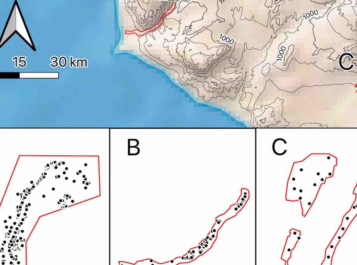
The researchers particularly highlight the extraordinary effectiveness of unstructured satellite surveys in uncovering up to 20% of archaeological sites in the enchanting coastal valleys of southern Peru. Twelve participants, with varying levels of expertise, conducted a remote survey over an area of 197 km² in the Sama and Moquegua valleys of central-southern Peru, comparing results with previous ground surveys that had documented 546 archaeological sites. Despite technological advancements, the study reaffirms the significance of visual detection, especially in areas lacking forest cover. The research also delves into automated and crowdsourcing approaches, emphasizing their limitations and underscoring the irreplaceable role of human experts in distinguishing between archaeological anthropogenic structures and modern features.
The study's focus lies in a comprehensive analysis of the effectiveness of unstructured satellite surveys, providing initial estimates of site frequencies, serving as a fundamental starting point, particularly for young scholars before delving into more specialized studies.
Regarding satellite imagery, accessible through platforms like Google Earth and Bing Maps, it emerges as a fundamental resource for conducting detailed investigations.
The evaluation of the effectiveness of unstructured satellite surveys in detecting archaeological sites took place in the desert region of Peru. Participants, with varying levels of expertise, primarily utilized Bing Maps images through QGIS, recording results for further in-depth analysis. The analysis focused on three coastal regions characterized by valleys, selecting areas with a documented history of ground surveys to ensure an accurate comparison between methodologies. The exceptional state of preservation, documented history of archaeological investigations, and lack of vegetation—favorable for remote sensing—influenced their selection.
Involving participants with skills in geographic information systems (GIS), research experience in the region, and participation in ground surveys, the investigation successfully provided a comprehensive assessment of satellite survey effectiveness. Comparison with archaeological controls from previous ground surveys offered a clear perspective on the validity of results obtained through this innovative methodology.
The text underscores the importance of an unstructured survey, devoid of specific guidelines, allowing for the evaluation of diverse methods employed by participants with various experiences.
It should be noted that the analysis acknowledges the limitation arising from the lack of detailed information about the satellite images used, paving the way for further research and developments in satellite-based archaeological investigations.


