In Archeofoss 2020, F. Battistin, S. De Angeli, F. V. Moresi, P. K. Fayad and M. Serpetti presented an article on RESEARCH -the European project on REmote SEnsing techniques for ARCHaeology- (abstract available at: https://zenodo.org/record/4002961#.YHgzlOgzaUk). This project aims to assess the damage caused by soil erosion to the CH, in exposed and buried archaeological areas. For this purpose a specific FLOS tool was developed, to create high resolution risk maps.
The soon-to-be-released proceedings of the ARCHEOFOSS 2020 conference will include an advance of the work developed in RESEARCH (REmote SEnsing techniques for ARCHaeology - H2020-MSCA-RISE- 2018 n. 823987). This is a European project that sets its sights on the creation of instruments for monitoring large-scale areas, and which provides a tool for the protection and conservation of archaeological heritage, through the planning of long-term interventions.
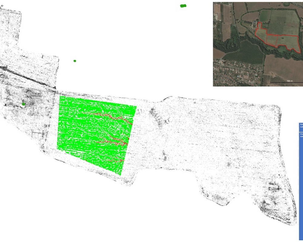
One of the topics studied is soil erosion: the removal of the superficial ground by natural and anthropic agents. This phenomenon can cause significant damage to the exposed or buried archaeological heritage. For this reason, RESEARCH proposes a new method to evaluate the archaeological risk assessment of a site, which processes the archaeological data together with the geological and environmental aspects of the area. This dataset was elaborated using a tool created in the opensource software QGIS, which was able to produce a detailed risk map for soil erosion impact on the archaeological heritage.
The chosen case study is a sample area of the archaeological site of Falerii Novi, Italy, an ancient Roman city that preserves a complex archaeological stratification. Despite having been placed under bond, the site is currently used for agricultural purposes, severely amplifying the erosive impact on the buried remains, which entails an increased risk for the conservation of the archaeological deposit.
The assessment of soil erosion and accumulations has been studied through a series of simulations using open-source models (RUSLE 3D, SIMWE and USPED). The generated soil erosion maps allowed evaluation of the amount of material removed and deposited in the study area. To conclude, these maps were drawn up in QGIS environment and processed together with the archaeological data to generate the final risk maps.
To learn more about this project and other FLOS uses for archaeology keep updated: https://www.youtube.com/watch?v=OPt3XURTP0g.
For the news about ARCHEOFOSS 2021: https://www.2343ec78a04c6ea9d80806345d31fd78-gdprlock/archeofoss
Copia qui lo "short link" a questo articolo
www.archeomatica.it/{sh404sef_shurl}